About the Project
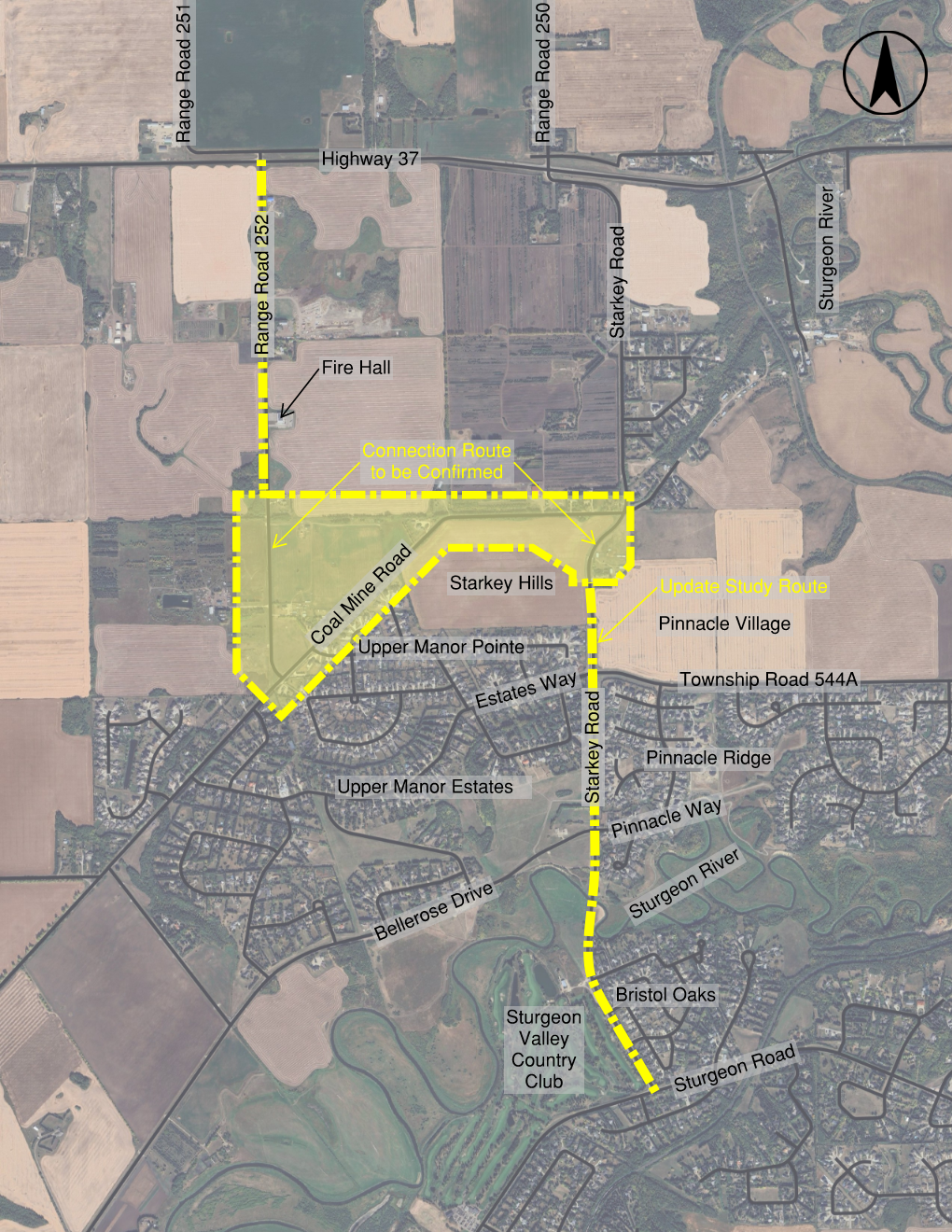
The Starkey Road functional planning study update looks at how Starkey Road connects between Highway 37 (north) and Sturgeon Road (south). The area includes farmland, acreages, and existing and future country estate residential development in the Sturgeon Valley area.
A previous functional planning study was completed in 2012 for the area between Bellerose Drive and Highway 37. The study recommended combining the intersections along Highway 37 into a future interchange at Range Road 252, with a curved road connecting Starkey Road and Range Road 252 near Coal Mine Road.
The study area includes the Protective Services Fire Hall along Range Road 252, south of Highway 37, as well as the Sturgeon River crossing.
The study aims to support future growth, reduce traffic moving through the community, and slow down vehicle speeds. It also looks at extending the trail network along the west side of Starkey Road and south side of Coal Mine Road.
What is a Functional Plan
A functional plan helps decide the future layout of roads, such as:
- how many lanes a road will have
- where intersections will go
- what the intersections will look like
- what the speed limits will be
- where people can enter or exit the road
The goal is to understand how these changes may affect nearby homes, land, and people. For example:
- will access points need to change?
- will land need to be purchased?
- how big will the impacts be?
Many factors are considered, including public and council feedback, utility locations, stormwater management, land impacts, and environmental factors (such as wetlands, tree stands, and historical land uses).
Why Now
The update to this functional plan builds on the 2012 study and is needed because:
- the project area now extends to Sturgeon Road, south of the river, to provide a plan for the entire Starkey Road corridor
- the County’s new Transportation Master Plan and the updated Sturgeon Valley Area Structure Plans (ASPs) do not include a curved road connecting Starkey Road to Range Road 252 near Coal Mine Road
- a provincial study is looking at changes to Highway 37 which would remove the need for an interchange at Range Road 252. This creates an opportunity to explore new intersection options
- the County has new standards for roadway design
Updating the study will help decide what land is needed for future upgrades and create a staging plan to guide when and how improvements should be built.


